Open beta · Android

Your map for the roads beyond the asphalt.

An offline map with forest roads and trails, GPS recording, routes for your vehicle, friends live on the map and SOS — built for gloves, sunlight and zero signal.

  • Works with no signal
  • Your trails stay yours
  • No ads
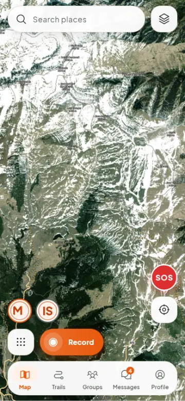
Satellite map with the trails and peaks of the Bucegi mountains
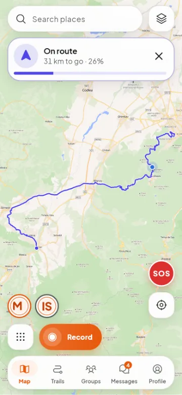
Following a route: 31 km left to Bran
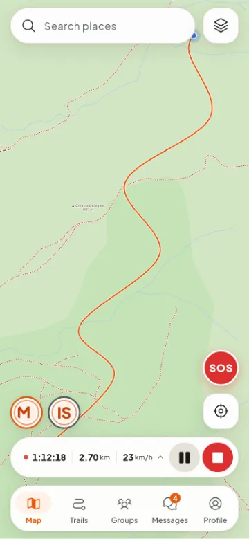
Recording a ride: time, distance and speed
Downloaded map · no signal
ATV route · 42 km
Built for ATV & UTV Enduro & moto 4×4 & SUV MTB & gravel Hiking
Features

Everything you need on the trail. Nothing you don’t.

Every screen is made to be used one-handed, on the move, with gloves on: big buttons, contrast for sunlight, a night theme.

An offline map made for the outdoors

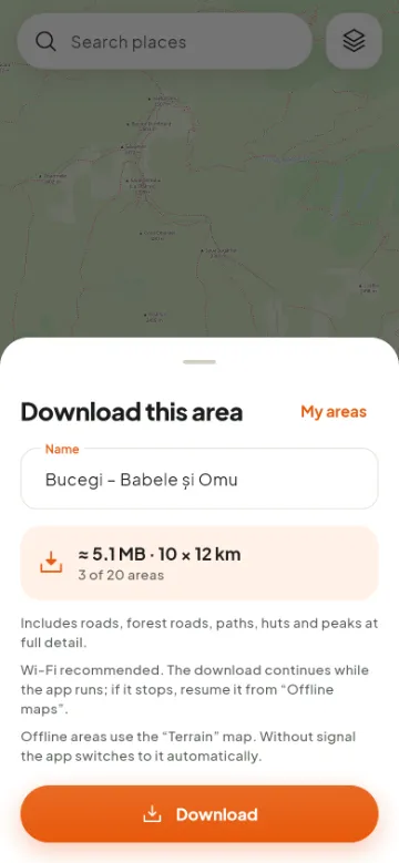
Forest roads, marked trails, peaks with altitude, springs and huts. Pick the area on screen, see how much space it needs and download it at home over Wi-Fi. In the mountains the map, recording and the trail you follow all work with no signal.

  • Terrain
  • Night
  • Satellite
Bucegi, 10 × 12 km
≈ 5 MB
trail-level detail
zoom 14
fresh OSM data
monthly
Downloading a map area for use with no signal

GPS recording that doesn’t get lost

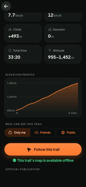
Time, distance, speed and altitude, with the screen off. If the phone kills the app, the ride is recovered. Export to GPX any time.

Altitude profile of a recorded trail

Routes for your vehicle

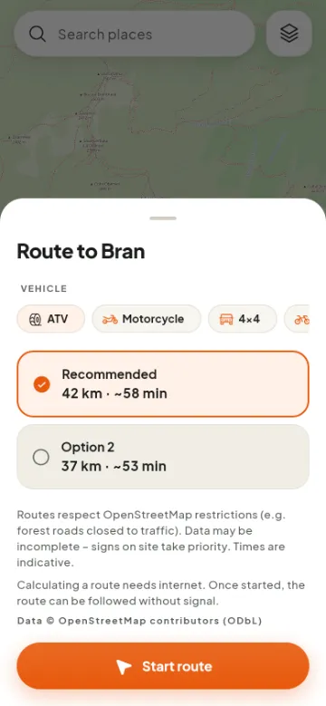
ATV, motorcycle, 4×4, bicycle or on foot: the route knows the kind of road and avoids reported obstacles. Start it and follow it even with no signal.

Choosing the vehicle and the route option to Bran

The terrain, from above

Satellite imagery with the roads, trails and names drawn on top. One tap to switch.

Satellite map

Trails checked by the community

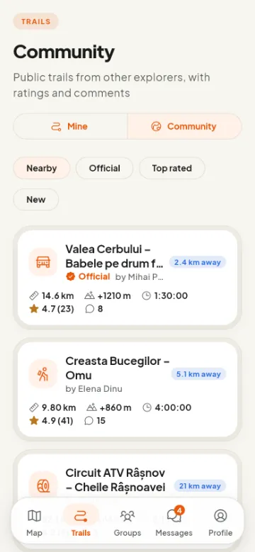
Public trails with ratings and comments. The best ones become official after review.

Community trails, including official ones

Friends live, groups, chat

See where everyone in the ride is, send your location as a link, talk in the group — text, photos, voice messages.

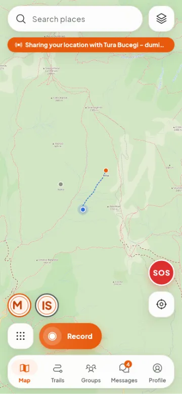
Friends on the map in real time

Works on the handlebars too

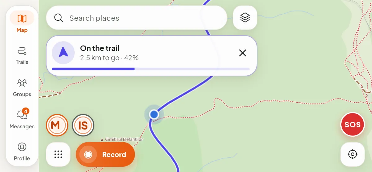
Portrait or landscape, in a handlebar mount or in your hand: the map stays big, the buttons stay within reach.

Navigating with the phone in landscape
Safety

When something goes wrong, every second counts.

A small SOS button on the map, always within reach. And the care that the alert gets through even where the internet doesn’t.

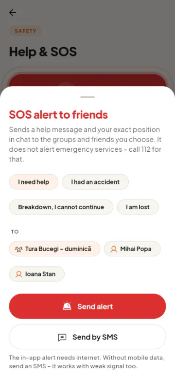
  • SOS alert with your exact positionTo the groups and friends you choose, in the chat, with coordinates and a map link.
  • No internet? By SMSThe alert goes out by text message — it works on a weak signal where mobile data doesn’t.
  • Live location that expiresShare your position for as long as you want; it stops by itself, so you never forget it on.
  • Obstacles on the mapFallen tree, deep ford, closed road: report it on the spot, others see it and routes avoid it.

RovTrail does not call emergency services by itself. In a real emergency, call 112.

SOS alert to friends and groups
How it works

Three steps. Then just the road.

  1. 01

    Download the area

    At home, on Wi-Fi: pick the area on the map and save it on your phone.

  2. 02

    Ride

    Record the ride or pick a route for your vehicle. The screen can stay off.

  3. 03

    Share

    The ride reaches your account when you get signal. Keep it, export it or propose it to the community.

Plans

Safety is free. Always.

SOS and live location never sit behind a subscription.

Free
€0
forever
  • Offline map: 1 area
  • Unlimited GPS recording, GPX export
  • 30 routes a day
  • SOS, live location, chat
  • Groups of up to 10 members
  • Community trails
PremiumBeta
At launch
During the beta: free with an invite code
  • 20 offline map areas
  • 300 routes a day
  • Groups of up to 50 members
  • Your vehicle’s icon on the map, with its brand
  • New Premium features as they arrive
Beta

Be among the first on the trail.

Leave us your e-mail. When a spot opens up, you get a code that unlocks Premium for free for the whole beta.

  • The Android app, straight from us
  • Free Premium for the whole beta
  • Tell us what’s missing — it really counts
What do you ride?
Your phone

You’re on the list.

We’ll write from [email protected] when your spot is ready. Check your spam folder too, at first.

FAQ

Frequently asked questions.

Does it work with no signal?

Yes. Downloaded map areas, GPS recording, following a trail or a started route and the SMS alert all work without internet. Search, calculating a new route, chat and the satellite map need internet.

Which phones does it run on?

Android for now, in beta. The iPhone version is in the works.

Which countries does it cover?

The map, routing and search cover Romania today, and coverage is growing country by country. GPS recording, imported GPX tracks, live friends, chat and SOS work anywhere.

How much does it cost?

The free plan stays free, including SOS and live location. We’ll announce the Premium price at launch; during the beta, Premium is free with an invite code.

Where does the map come from?

From OpenStreetMap, updated monthly and hosted on our own server, with a style made for the outdoors: forest roads, marked trails, altitudes. On the ground, local signs and restrictions always come first.

What happens to my data?

Your trails are private until you choose to publish them. Live location only reaches the people you pick and expires by itself. We don’t sell data and show no ads. You can export or delete all your data from the app.

Can I use GPX tracks?

Yes: import GPX (Garmin, Strava, Wikiloc and so on) and follow it on the map, even with no signal. And export your own rides to GPX.